
|


Cumulonimbus clouds (Cb) are much larger and more vertically developed than fair weather cumulus. They can exist as individual towers or form a line of towers called a squall line. Fueled by vigorous convective updrafts (sometimes in excess 50 knots), the tops of cumulonimbus clouds can easily reach 39,000 feet (12,000 meters) or higher.
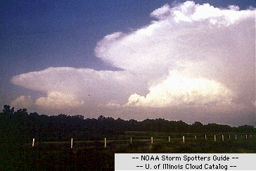
Photograph by: NOAA
Lower levels of cumulonimbus clouds consist mostly of water droplets while at higher elevations, where temperatures are well below 0 degrees Celsius, ice crystals dominate. Under favorable atmospheric conditions, harmless fair weather cumulus clouds can quickly develop into large cumulonimbus clouds associated with powerful thunderstorms known as supercells.
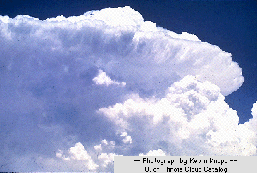
Photograph by: Knupp
Supercells are large thunderstorms with deep rotating updrafts and can have a lifetime of several hours. Supercells can produce frequent lightning, large hail, damaging winds, and tornadoes.
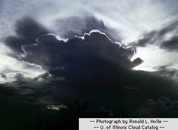
Photograph by: Holle
These storms tend to develop during the afternoon and early evening when the effects of heating by the sun are strongest. For more information about supercells and other types of severe weather phenomena, visit the Severe Storm Spotters Guide.
|
fair wx cumulus |
|
Other Cloud Types |