
|


Warm fronts are not always identifiable by simply examining the temperature field alone. Other fields must also be taken into consideration. For example, below is a surface weather map with an analyzed low pressure center (red "L") and associated cold front (blue line) and warm front (red line). The numbers are surface temperature reports and the symbols are wind barbs, indicating wind direction and wind speed.
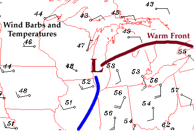
At the time this map was generated, temperatures ahead of the warm front were in the 40's, while behind the front, temperatures were only slightly warmer (in the 50's). However, notice the change in wind direction (as indicated by the wind barbs) from one side of the warm front to the other. Winds ahead of the warm front were generally from the east, while behind the front, winds had shifted around and were blowing out of the south. This sudden shift in wind direction was the key indicator that a warm front was present.
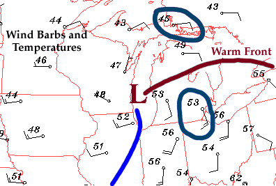
A sudden change in wind direction is commonly observed with the passage of a warm front. Before the front arrives, winds ahead of the front (in the cooler air mass) are typically from the east, but once the front passes through, winds usually shift around to the south-southwest (in the warmer air mass).
|
definition |
|
higher dew points |