
|


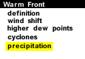
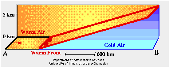
The animation below is a sequence of vertical cross sections depicting the development of precipitation ahead of and along a warm front. The region shaded in blue represents a colder air mass while the yellow shading indicates the warm moist air behind the warm front (solid red line).
Animation by: Hall
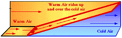
The frontal zone slopes up and over the colder air mass ahead of it. Warm air rides along the front (up and over the cold air mass), cooling as it rises, producing clouds and precipitation in advance of the surface warm front. Because the lifting is very gradual and steady, generally wide spread and light intensity precipitation develops ahead of a warm front.
A Closer Examination of the Animation:
Initially, a warm air mass (in yellow) nudges against a colder air mass
(in blue) ahead of it, (separated from each other by the warm front).
The lighter warm moist air
behind the front is lifted upward and "overrides" the
colder air.
As the air rises, it cools, and if enough water vapor condenses, widespread clouds and precipitation develop.
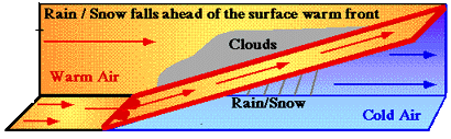
A layer of thin clouds is occasionally observed more than a thousand kilometers in advance of a surface warm front. As the front gets closer, the clouds thicken and eventually light precipitation begins to fall. Because the frontal surface gently slopes up and over the cold air mass ahead of it, the upward motions associated with warm fronts are typically not as strong as the vigorous upward motions that occur ahead of a cold front.
|
cyclones |
|
Fronts |