
|


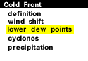
Another indication of a possible frontal passage is a change in the air's relative humidity. The air mass ahead of a cold front is typically more moist than the air mass behind it. The surface map below contains reports of temperature, dew point temperature, and wind barbs. Higher dew points indicate a higher moisture content of the air. Ahead of the cold front analyzed below, dew point temperatures were generally in the 50's, while behind the front, dew point values dropped off into the 30's and 40's.
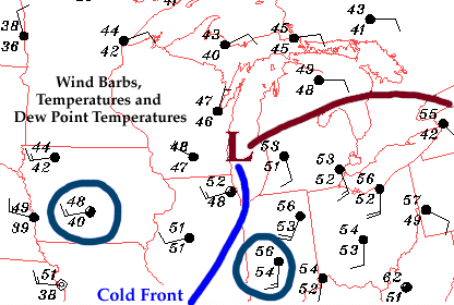
This decrease in dew point temperature indicated the presence of drier air behind the cold front. A noticeable change in the air's relative humidity is commonly observed with the passage of a cold front. Before the front arrives, the air typically feels more humid (in the warmer air mass), but once the front passes through, the humidity decreases and the air feels drier.
|
wind shift |
|
cyclones |