
|


Those who live in northern portions of the United States expect cold weather during the winter months. These conditions usually result from the invasion of cold arctic air masses that originate from the snow covered regions of northern Canada. Because of the long winter nights and strong radiational cooling found in these regions, the overlying air becomes very cold and very stable. The longer this process continues, the colder the developing air mass becomes, until changing weather patterns transport the arctic air mass southward.
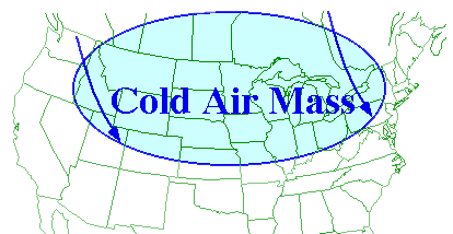
Arctic air masses move about as a shallow area of high pressure, commonly known as an "Arctic High". Northerly winds associated with a cyclone and trailing anticyclone, (the center of the arctic air mass), transport the colder air southward. Since the terrain is generally flat and free of any significant topographical features, arctic air masses entering the United States and can easily slide all the way to Texas and Florida.
Below is a map of surface observations and the leading edge of a large arctic air mass blanketing much of the United States has been highlighted by the blue line. The center of this air mass is a high pressure center located in northern Montana (indicated by the blue "H").
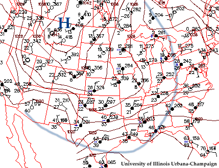
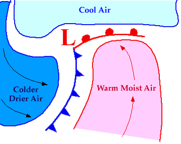
From these reports, we see that most stations in the arctic air mass generally exhibit relatively colder temperatures, with lower dew point temperatures, and winds generally out of the north. Notice that on the other side of the blue boundary, outside of this air mass, surface conditions are much different, which indicates the presence of an entirely different air mass.
|
introduction |
|
maritime tropical |