
|


Reference Weather Map |
Current Weather Map |
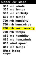
This panel shows the 700 mb field for geopotential height, and vertical velocity. 700 mb charts depict conditions in the middle troposphere (roughly 3000 meters). This is also referred to as the steering level, since most weather systems are "steered" by the winds at this level.
Geopotential height approximates the actual height of a pressure surface above mean sea-level and is represented by the solid white contours. The geopotential height field is given in meters with an interval of 30 meters between height lines. The locations of surface cyclones and anticyclones hold similar positions in the 700 mb geopotential height field.
Vertical velocity is the speed at which the air is rising or sinking. Locations where air is rising are the locations most likely to produce precipitation. Vertical velocity is measured in -ub/s, or negative microbars per second. Velocities are always distance divided by time (like miles per hour), and this is no different. Instead of meters or miles, though, the distance measured is pressure. Remembering that pressure decreases as altitude increases, a relationship between pressure and altitude is established. Due to this relationship, a negative distance in pressure is actually a positive distance in altitude, hence a negative microbar distance is used here.
|
700 mb hum,winds |
|
700 mb temps |