
|


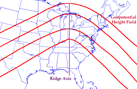
When the height contours bend strongly to the north (as in the diagram below), this is known as a RIDGE. Strong ridges are accompanied by warm and dry weather conditions at the surface. Below is an example of a ridge in an upper-level height field (red contours). The purple line denotes the ridge axis.
The image below depicts
geopotential height (solid white contours) and
temperatures (colored regions) at 500 mb. Temperatures decrease with color
from light blue to purple.
A ridge is located from Texas into Montana and is indicated by the
bulge in the geopotential height field.
This is the upper level extension of
a surface high pressure center,
which is why ridges are also called upper level highs.
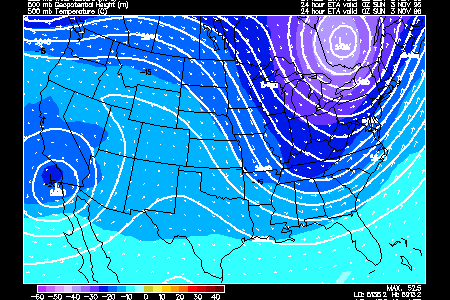
Notice the relatively warm temperatures associated with the ridge. This
is caused by the northward transport of warmer air in the lower troposphere.
The ridge will intensify (bulge further northward) if warm air continues
to move northward at low levels in the troposphere.
|