|

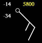
The value highlighted in yellow located in the upper right corner (in the diagram above) represents the geopotential height of a given pressure surface in meters (as reported by weather balloons).
Geopotential Height approximates the actual height of a pressure surface above mean sea-level. Therefore, for the example given above, the height of the pressure surface on which the observation was taken is 5800 meters.
When a collection of geopotential height reports are contoured on a given pressure surface, we are able to identify upper air troughs and ridges, which are very important influences on surface weather conditions.

dew point |
|

wind barbs |


