
|

 |
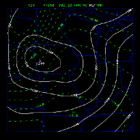 |
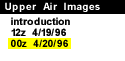
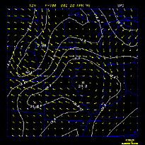
The chart below provides access to an array of upper air analysis plots for the time of 00Z April 19, 1996. These images show the upper level conditions that existed during the time of the severe weather outbreak.
/arch/cases/960419/data/upr/upa/ilx.gif)
/arch/cases/960419/data/upr/upa/hodo.gif)
| Level | Height, wind | Temperature (C) | Dewpoint (C) | Wind, speed (m/s) | Vorticity (/s*1e5) | Ageostrophic wind |
|---|---|---|---|---|---|---|
| 920 mb | image | image | image | image | image | image |
| 850 mb | image | image | image | image | image | image |
| 700 mb | image | image | image | image | image | image |
| 500 mb | image | image | image | image | image | image |
| 300 mb | image | image | image | image | image | image |
/arch/cases/960419/data/upr/upa/00z.920.ht.gif)
/arch/cases/960419/data/upr/upa/00z.920.temp.gif)
/arch/cases/960419/data/upr/upa/00z.920.dewpt.gif)
/arch/cases/960419/data/upr/upa/00z.920.wind.gif)
/arch/cases/960419/data/upr/upa/00z.920.vort.gif)
/arch/cases/960419/data/upr/upa/00z.920.ageo.gif)
/arch/cases/960419/data/upr/upa/00z.850.ht.gif)
/arch/cases/960419/data/upr/upa/00z.850.temp.gif)
/arch/cases/960419/data/upr/upa/00z.850.dewpt.gif)
/arch/cases/960419/data/upr/upa/00z.850.wind.gif)
/arch/cases/960419/data/upr/upa/00z.850.vort.gif)
/arch/cases/960419/data/upr/upa/00z.850.ageo.gif)
/arch/cases/960419/data/upr/upa/00z.700.ht.gif)
/arch/cases/960419/data/upr/upa/00z.700.temp.gif)
/arch/cases/960419/data/upr/upa/00z.700.dewpt.gif)
/arch/cases/960419/data/upr/upa/00z.700.wind.gif)
/arch/cases/960419/data/upr/upa/00z.700.vort.gif)
/arch/cases/960419/data/upr/upa/00z.700.ageo.gif)
/arch/cases/960419/data/upr/upa/00z.500.ht.gif)
/arch/cases/960419/data/upr/upa/00z.500.temp.gif)
/arch/cases/960419/data/upr/upa/00z.500.dewpt.gif)
/arch/cases/960419/data/upr/upa/00z.500.wind.gif)
/arch/cases/960419/data/upr/upa/00z.500.vort.gif)
/arch/cases/960419/data/upr/upa/00z.500.ageo.gif)
/arch/cases/960419/data/upr/upa/00z.300.ht.gif)
/arch/cases/960419/data/upr/upa/00z.300.temp.gif)
/arch/cases/960419/data/upr/upa/00z.300.dewpt.gif)
/arch/cases/960419/data/upr/upa/00z.300.wind.gif)
/arch/cases/960419/data/upr/upa/00z.300.vort.gif)
/arch/cases/960419/data/upr/upa/00z.300.ageo.gif)
|
12Z 4/19/96 |
|
Superstorm '93 |