
|


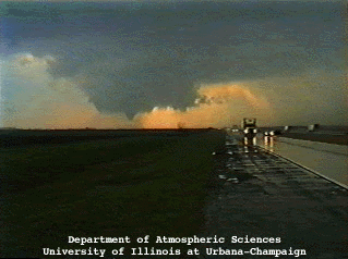
Before the first tornado was spotted, the video camera was on the sky, capturing some impressive cloud to ground lightning strokes (shown below). Approximately 10 miles east of Jacksonville, Illinois at 6:05 PM CDT, the storm interceptors were traveling eastbound on US HW 36 when the tornado dropped out of the sky 2 miles behind them. Gwen Jewett first spotted the tornado when she just happened to look in the rearview mirror. Pulling off to the side of the road, the crew set the video camera on tripod and began recording.
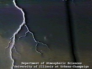
A "striking" cloud to ground (CG) lightning bolt which emanated from a supercell thunderstorm located 12 miles southwest of Jacksonville, Illinois.
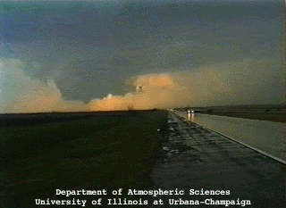
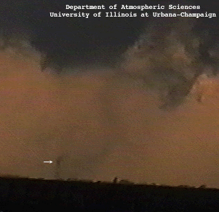
Looking west at a wall cloud and tornado condensation funnel along US HW 36 approximately 10 miles east of Jacksonville, Illinois.
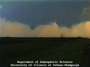
At this time, a translucent debris shield was apparent below the condensation cone which was located about 3 miles from our filming site.
The short-lived tornado was rated by the National Weather Service at F2 intensity and had a 1/2 mile path width.
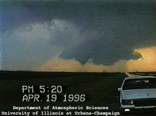
Note that the time is 5:20 PM Central Standard Time (CST), which is 6:20 PM (CDT).
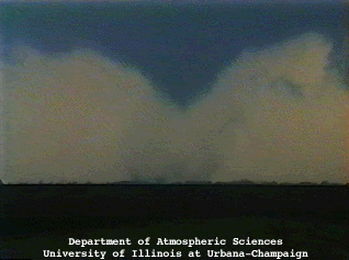
Close-up picture of the tornado featuring an obvious debris cloud residing below the condensation cone. At this time, the tornado was paralleling US HW 36. Only very light rain is falling at our location.
Zooming in on the tornado reveals smaller suction vortices within the larger circulation during the tornado's approximate 10 minute lifetime.
|
summary |
|
jacksonville video |