
|


A gust front is a boundary that separates a cold downdraft of a thunderstorm from warm, humid surface air. Its passage at the surface resembles a cold front. A macroburst (damaging thunderstorm gust front) was advancing from northwest to southeast in this westward view across the West Texas prairie. Note the well-developed mammatus field under the leading anvil, and the new updrafts being lifted along the gust front.
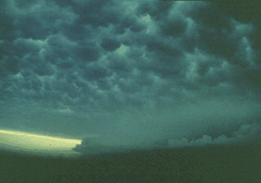
Photograph by: Doswell
The question of whether or not new storms will form along a gust front is a difficult one to answer. If the gust front is moving quite fast and the atmospheric instability is marginal, new storms are not likely to develop. Research has indicated that low-level vertical shear profiles in the outflow field should be of equal but opposite sign of the shear in the low-level inflow air for the optimal redevelopment along the outflow boundary.
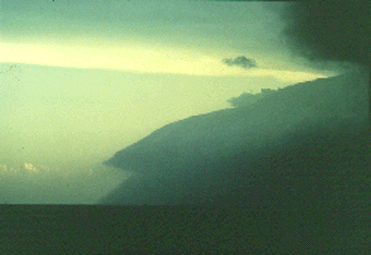
Photograph by: Doswell
A telephoto shot highlights the approach of the gust front. This complex had the appearance of a haboob, a dense sandstorm that occurs along the leading edge of outflow boundaries of desert thunderstorms in North Africa. Indeed, it was dust beneath the shelf cloud that resulted in this appearance, and the outflow was of downburst proportions.
|
Outflow Phenomena |
|
visual clues |