
|


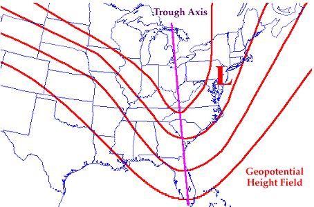
When the height contours bend strongly to the south, (as in the diagram below), it is called a TROUGH. Strong troughs are typically preceded by stormy weather and colder air at the surface. Below is an example of a trough in an upper-level height field (red contours). The trough axis is denoted by the purple line.
The image below depicts
geopotential height (solid white contours) and
temperatures (colored regions) at 500 mb. Temperatures decrease with color
from light blue to purple.
A trough is located over the eastern United States and is indicated by the
dip in the geopotential height field.
This is the upper level extension of
a surface low pressure center,
which is why troughs are also called upper level lows.
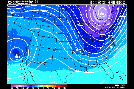
Notice the relatively cold temperatures associated with the trough. This
is caused by the southward transport of colder air in the lower troposphere.
The trough will intensify (deepen further southward) if cold air continues
to move southward at low levels in the troposphere.
|
geopotential height |
|
ridges |