
|


The most common form of high-level clouds are thin and often wispy cirrus clouds. Typically found at heights greater than 20,000 feet (6,000 meters), cirrus clouds are composed of ice crystals that originate from the freezing of supercooled water droplets. Cirrus generally occur in fair weather and point in the direction of air movement at their elevation.
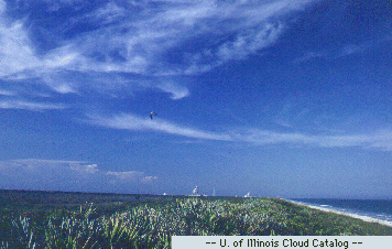
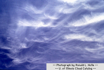
Cirrus can form from almost any cloud that has undergone glaciation and can be observed in a variety of shapes and sizes. Possibilities range from the "finger-like" appearance of cirrus fall streaks to the uniform texture of more extensive cirrus clouds associated with an approaching warm front.
Photograph by: Holle
Fall streaks form when snowflakes and ice crystals fall from cirrus clouds. The change in wind with height and how quickly these ice crystals fall determine the shapes and sizes the fall streaks attain. Since ice crystals fall much more slowly than raindrops, fall streaks tend to be stretched out horizontally as well as vertically. Cirrus streaks may be nearly straight, shaped like a comma, or seemingly all tangled together.
Similar to fall streaks is virga, which appears as streamers suspended in the air beneath the base of precipitating clouds. Virga develops when precipitation falls through a layer of dry air and evaporates before reaching the ground.
|
Cloud Types |
|
cirrostratus |