
|


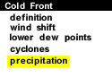
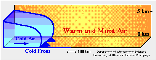
The animation below is a sequence of vertical cross sections that depict the development of precipitation ahead of and along a cold front. The surging blue mass represents colder air behind the cold front (solid blue line) while the yellow shading indicates the warm moist air mass ahead of the front.
Animation by: Hall
As the front advances, the colder air lifts the warmer air ahead of it (red arrows). The air cools as it rises and the moisture condenses to produce clouds and precipitation ahead of and along the cold front. In contrast to lifting along a warm front, upward motions along a cold front are typically more vigorous, producing deeper clouds and more intense bands of showers and thunderstorms. However, these bands are typically quite narrow and move rapidly just ahead of the cold front.
A Closer Examination of the Animation:
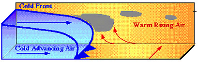
Initially, the cold air mass wedges into the warmer air mass
ahead of it, (separated from each other by the
cold front).
The lighter warm air
is lifted upwards by the denser cold air and
if enough water vapor condenses,
clouds develop.
If condensation of water vapor persists, precipitation may develop, typically in a narrow band just ahead of the cold front.
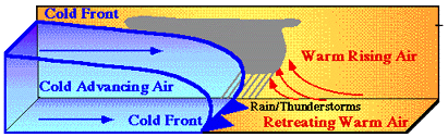
Due to the steep slope of a cold front, vigorous rising motion is often produced, leading to the development of showers and occasionally severe thunderstorms.
|
cyclones |
|
Warm Front |